
charlesclosesociety
AN HISTORICAL MAP OF CAMBRIDGE, University and County Town
AN HISTORICAL MAP OF CAMBRIDGE, University and County Town
Regular price
£10.99
Regular price
£10.99
Sale price
£10.99
Unit price
per
Tax included.
Couldn't load pickup availability
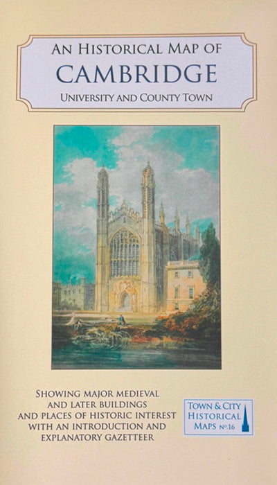
The Historic Towns Trust’s new map of Cambridge, researched and compiled by Elizabeth Baigent and Tony Kirby, with cartography by Giles Darkes and Tim Goodfellow, was published on 22 November 2023. The map is no. 16 in their Town and City Historical Maps series. It gives an overview of the history and topography of the city, showing the many layers of occupation over the centuries, from the Roman period onwards. Roads, the river, markets and famous fairs, religious houses, and from the 13th century the university, created a complex web of activities, interests, and settlers. College and University buildings now dominate the townscape, but Cambridge also has a wide range of civic and public buildings and churches built for the town’s population.
This is their second map of Cambridge: the first was published in 1975, as one of four towns in Volume II of the Historic Towns Atlas, with an introduction by the then editor, Mary D. Lobel, and cartography by Col. Henry Johns. The new publication uses the Ordnance Survey map surveyed in 1925 as its base, and incorporates much new information from documentary and archaeological research since the first map was published. It continues Cambridge’s story into the 19th and early 20th centuries, and uses a much wider range of colours and symbols to distinguish features.
At 1:2500, the new map covers the area from Castle Hill and the beginning of the Huntingdon Road in the N to Newnham in the SW and the railway station in the SE. It shows the dense network of somewhat irregular streets in the city centre, surrounded by larger areas of mostly 19th-century development and an unusual amount of green space, public and private. The Reformation had a major impact on the town, with the closure of friaries and nunneries and the foundation of new, explicitly Protestant colleges, sometimes on the same sites. There was then quite a long gap before the next wave of college foundations in the 19th century, including some catering to hitherto excluded constituencies such as nonconformists and women. The date of the base map survey, 1925, reveals a changing Cambridge, with Fen Causeway under construction and Burrells’ Walk covered in temporary housing, a few years before the establishment there of the new University Library. The gazetteer on the reverse of the sheet gives brief accounts of major buildings and features, including all the churches and colleges shown on the map. The reverse also shows images of Cambridge including reproductions of two very little known 17th-century oil paintings of Jesus and Emmanuel colleges, early photographs, and a picturesque watercolour by a woman artist.